Community
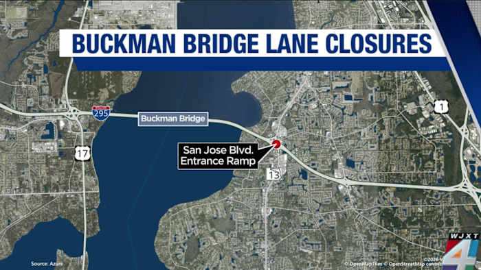
FDOT apologizing in advance for second weekend of Buckman Bridge lane closures in a row
By Marcus Chen
News4JAX Local
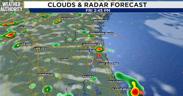
Expect a stormy, steamy day, with the best chances of showers and thunderstorms after 2 p.m.A few of those storms could pack a punch. Some thunderstorms may produce wind gusts between 40 and 55 mph, fueled by afternoon sea breezes drifting inland from the coast.Temperatures will be a touch cooler than recent days, topping out in the low to mid 90s. But don’t let that fool you — the air will still feel dangerously oppressive. The “feels-like” temperature is expected to reach 100 to 107 degrees through the afternoon, just under the threshold for an official heat advisory.Storm activity should taper off after sunset as daytime heating fades. Overnight lows will settle into the low to mid 70s.Saturday’s OutlookSaturday brings another round of storm chances.The sea breeze will push west, sparking showers and thunderstorms across north-central Florida before shifting eastward. Highs stay in the low-to-mid 90s with more cloud coverage.
Ad Space Available
mid-article · 728px
By Marcus Chen
News4JAX Local

By Katherine Langford
News4JAX Local

By Marcus Chen
First Coast News Local

By Marcus Chen
First Coast News Local